Wednesday, September 23, 2009

The 15


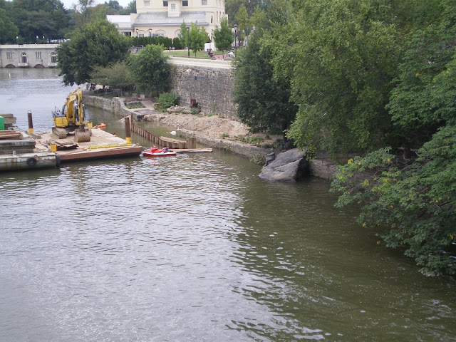
The 15 is Philadelphia’s only active fully surface trolley route. It runs from the Port Richmond loop, along Port Richmond Avenue about a quarter mile inland of the Tioga Marine Terminal down aforesaid avenue to I-95’s Girard Avenue exit, where it then turns onto Girard and crosses 95; it runs down Girard through Fishtown, the Northern Liberties, Ludlow, past the old Allen homes, and on into Francisville and Fairmount before it crosses the Schuylkill and thence past the Zoo into Parkside towards Mantua on into the no-man’s-land of far West Philly (or: my excuse as to why I haven’t taken it west beyond Parkside and Girard.) Along this route it crosses the (inactive) 23’s trolley tracks (at 11th and 12th), an inactive route running along 40th, another one heading up Parkside, the 10 at Lancaster, and IIRC another one elsewhere in West Philly.


When trolley service along the 15 was restored, it was done in the most inept way possible. There are portions of the route (e.g. Port Richmond Avenue) which are so narrow as to make roadway and trolleyway right-of-way (or ROW from now on) separation impossible; this is a major issue with the 23, where Germantown Avenue only has two travel lanes frequented by six lanes’ worth of traffic and has been one of several impediments to service restoration there; however, along Girard between 95 and Broad, Girard (and consequently the 15) enjoys some of the most generous right-of-way in the city. Yet even here the roadway impinges, as left-turn lanes and inner lanes commonly share space with trolley ROW. From Broad west to the Schuylkill, Girard narrows again; west of it, it becomes (again) a wide road at least so far as Parkside Avenue; it is in this portion that the 15 enjoys its most total ROW separation, as no traffic is allowed in the trolley lanes between Parkside and 34th and there are no traffic markings in them to vindicate drivers. This should be the case along all of Girard where there is space for a traffic lane without impinging on trolley ROW.


From 34th to Broad things get tricky. The road narrows into two traffic-trolley lanes and two parking lanes throughout. Where speed is enjoyed crossing the Schuylkill delay is the most common experience here. West of Girard, along the business corridor, this is no big deal, as the delay is accompanied by the beneficial experience of window-shopping, but east of it, in the more residential Francisville district, this delay can become wholly irritating. Worse, here it is unwarranted. The sidewalks along this part of Girard are exceedingly wide for the traffic generated, and a great deal of traffic winds up being rerouted onto Poplar due to the confusing traffic layout just west of Girard College. Thus neither Girard nor Poplar in Francisville take the full brunt of arterial traffic load, but instead both take about half the load—at least until drivers figure out they’re on the wrong street.


In Francisville, this can be exploited to both a) fully grade-separate the 15 and b) spur development along Poplar east of Ridge. By redirecting through traffic down Poplar—since most through traffic here is through to Broad and not 95, as Broad is the traffic pump into and out of Center City in this area—and local traffic down Girard, we reduce Girard’s traffic load. By removing about a third of the current sidewalk for parking (not traffic) lanes, we can separate the trolley ROW from the roadway. And lastly, by condensing the trolley stops to just three—at Ridge, at St. Joe’s Hospital, and orienting them in the same way the Zoo stop already is, we can fit two carstops into an area where street width only apparently offers one (and even then that is gained by eliminating the parking lanes by the stops). Where Girard meets broad the built environment disallows any modification on the current eastbound lanes by sidewalk removal, but in this block an advantageous built environment (the Checkers) on the northbound side makes for some very interesting options. My suggestion in this debate would be to—realign the eastbound tracks to make the curb the carstop (that is, move them about ten feet south), make the current roadway/ROW roadway only (and the trolley tracks ROW only), and provide two grade crossings were the trolley literally physically bumps out to provide a stop.


East of Broad, the ROW needs to be fully grade-separated through to Fishtown. Largely unused parking lanes can be eliminated, and a possible 15-Regional Rail connection could be built at 9th and Girard. This grade-separation would entail the conversion of several cross-streets into double T’s, namely those not hosting bus routes en toto since those that do are more important than those that don’t. Left-hand turns would not be made in the trolleyway, since of course there would be no place to do it, and this of course eliminates the need for crash bumpers on the back of the carstops.


One other major issue is waiting at the carstops: there is a lack of protection from the elements at most of them. Installing bus shelters (more in the mold the current RR waiting shelters rather than the fugly old bus ones already in place) along the carstops would be exceedingly useful.


And of course, this is not the optimum route for a historic trolley. The 23 through Germantown is. When SEPTA replaces the Kawasaki LRVs currently operating along the Subway-Surface network, it should order enough for the 15 to be a permanent trolleyway—and eliminate the concrete asphalt from the trolleyway whenever possible.


Here is the alignment I’m proposing.

Monday, September 21, 2009

Gettysburg

This weekend I went camping at Gettysburg. We camped in Caledonia State Park, in the gap between South Mountain and the Blue Ridge, and spent most of Saturday and part of Sunday at the park proper.

The park is such an unusual place. You feel like you're going back in time when you're in it--the forest and field boundaries in the main battlefield are still where they were in 1863, when the battle was going on. Old wooden fences crowd the field--in the same state they were in before its start. And the monuments! You can't walk twenty feet in some places without bumping into a monument. Every regiment, every general, has its own monument, has his own monument. Marble adorns the field, with ceremonial cannon for the artillery units. Just by tracing the monuments, you can get a sense of where Pickett was, where Longstreet was, where Meade's lieutenant generals were. And the field extends for more than a mile--all the way from Little Round Top and the Devil's Den opposite Plum Run north to the town itself. Following the path of Pickett's Charge, to the High Water Mark, you can see the buildings in town! Only autos instead of carriages, asphalt on the roads instead of dirt, mar the view that has otherwise remained unchanged since Civil War times.

Gettysburg is such an odd place. In one sense it lives intensely, but only because large parts of it have died--died not the way people do, but the way languages do. The whole park, the whole town, is one giant historic district, stifled in its own pomp and circumstance, continually recreating the modes and mores of nineteenth-century life, outdated the same way Williamsburg is. It is a living museum and a tourist trap--a dead place. And yet, peculiarly, this death has given Gettysburg a life it would never have otherwise had, for the place is now a powerful national draw. It is crowded, stuffed to the gills with visitors, visitors which propel and drive Gettysburg and make it look a certain way, not just in one place, but throughout the town. The park limits the town's growth in nearly every direction, and so it remains a compact, small burgh in the traditional mode; between the tourist traps the main street survives; there is little sprawl until one has skipped town by a goodly distance, mostly to the north, south, and east, and hardly any to the west.

Ghosts haunt this place, yes, but not the ghosts of ghost tours. Rather, the ghosts of the past pervade the present here, shape its reality, for the whole place is, after all, a giant museum and a national shrine. It is stilted but for what it is it could be nothing else.

When you go to Gettysburg, make sure you see the sparkly new visitors center. Pay respects to Neutra's cyclorama before it falls apart. Follow Pickett's Charge's path. Play in the Devil's Den and on Little Round Top; hike the Big Round Top. Milk the place for all its worth. And bring a friend.

Monday, September 14, 2009

Upper Francisville

The neighborhood between Broad, Fairmount, Girard, and Corinthian is known as Francisville due to the fact that it encompasses an old village once named Francisville. In fact, this old village creates the interesting situation where there is a secondary inner grid--the grid pattern of Francisville village--tucked into the main Philadelphia grid. Unsurprisingly, Francisville's grid is aligned to Ridge, which at that time was a key interurban highway; it is this grid, surrounded by the broader citywide grid, which gives Francisville its character.

Francisville is considered to be the same type of neighborhood as Sharswood--that is, in early gentrification. It is bordered by Fairmount to the west and Sharswood itself to the north, both bearing strong gentrification pressures. Fairmount is organized around Fairmount Avenue, its main corridor being the section that runs between the Eastern State Penitentiary and the Perelman Annex to the Art Museum, a prime tourist gateway; as Francisville's southern border, Fairmount has the possibility of channeling this energy eastwards all the way to Broad. The same runs along Girard.

In fact, one of the things I noticed most quickly was that the artefacts of gentrification--sale signs (instead of rent) and renovation--are clustered around Girard Avenue; this is a pattern that meshes well with what is so on Fairmount (another subject for another day). A major lack of businesses of any sort, though, can be noted, although Ridge ought to be one of the strongest commercial corridors in the city. What happened?--the Schuylkill Expressway diverted traffic that supplied these businesses, making them go bankrupt one by one, and if that weren't enough, widespread neighborhood disinvestment occurred throughout this corridor, bringing about a characteristically weak, slummy district: from Callowhill through Ludlow and Francisville, Sharswood and Strawberry Mansion the Ridge Avenue corridor is in severe distress; it only begins to improve again in East Falls. What this tells us is that a healthy commercial corridor requires a healthy (middle-class) degree of neighborhood investment: disinvested neighborhoods, by their very nature, produce disinvested commercial districts.

What, then, constitutes a disinvested neighborhood? Blight is the most obvious factor, blight Francisville has in spades. Along Poplar there is no small amount of vacancies. The Met at it and Broad is in a state of half-ruin; they have been trying to raise funds for its renovation, but the process has been slow; lots abound, particularly between 15th and 16th where one feels almost one is walking through a fallow field bisected by asphalt and concrete; vacancies--abandoned houses--abound. Signs are For Rent instead of For Sale. There is less sidewalk traffic; those who do dare traverse display hopelessness. This part of Francisville is severely blighted; this blight is related (this is no expert's opinion) to the disinvestment and blight along the Ridge corridor.

Yet west, in the off-kilter grid, along Wylie, a different situation emerges. Looking down the cross-streets blight again re-emerges, yet along Wylie itself houses are in good repair and still there; along Perkiomen houses are still there, in good repair. Occasional vacancies crop up, but here the living conditions are better, here there is life, the sidewalk, while not bursting, has a decent amount of people using it. This neighborhood, then, has some health, but not enough: it, too, is tied into Ridge, and without the Ridge corridor's function as a central neighborhood market, this neighborhood is much too weak: how it's so healthy is a worthy question to ask all by itself. Do these denizens shop where Fairmounters do? Is the mean income of these people higher than their counterparts on Ridge's other side? But life is here and so, therefore, opportunity.

Construction work is being done at 19th and Poplar; there is some ongoing in other parts of the neighborhood, but here it seems stronger. Between Girard and Poplar lies the gentrification lane; in the off grid lies the healthiest (though by no means vibrant) neighborhoods. Temple students seem to occupy a large portion of those apartments in the gentrification corridor; this form of gentrification is greatly limiting (look at Templetown).

A church lies at Girard and Ridge, at the end of an intact row of semi-brownstones, mansions for the industrial nouveau riche. Once it was a bank: Northwestern, the sign, still etched into the lintel, tells me. It is a late Victorian design: Furness? The degree of richness and eclecticism, the tomb-of-stone feel it emanates seems to indicates it was he. If so, the importance of this row, besides its inherent physical beauty, is amplified: few verified Furnesses still exist. Many of the best were completely demolished in some revitalization program or another.

A Google Map.

Sunday, September 13, 2009

The Good, The Bad, and The Ugly

The Good:
The Phillies beat the Mets and the Eagles routed the Panthers! Huzzah!

Sean McDermott has emerged as a worthy successor to Jim Johnson; the Eagles 'D' had a career day today, allowing only three points after the middle of the first quarter; and DeSean Jackson had a punt return for a touchdown today, too.

The Bad:
Lidge still cannot save a game for beans. He was 'fresh' and should have had a 1-2-3 lights-out inning, but instead the Mets scored two runs on him and had a runner on base even as he got the final out. Brad Lidge is not the Phillies closer anymore, but neither is Madson, and so far I haven't had a chance to assess Myers.

Also, the Eagles O-line still hasn't got it all together. There were a few too many times that McNabb (and later Kolb, get to him soon) were hurried, even though (so far as I know) they weren't sacked. Kolb had a fumble because Carolina's D penetrated our O at least once. This issue, though, ought to be resolved as the season wears on.

The Ugly:
Donovan McNabb was injured; he cracked three ribs when he ran that touchdown in. He is expected to miss three-to-five weeks.

Thursday, September 10, 2009

Autumn

It's a chilly day but I haven't got a lot to talk about. The leaves are dropping; fall is here; be sure to wash your hands, folks! or beware getting the swine flu or what-have you...

Wednesday, September 9, 2009

Temple's Plans

The Inky today had an interesting piece on Temple University's future plans. This is important for several reasons, they being that the University has several pieces of abominable pieces of Brutalism on campus that need replacing (Beury, Barton, and the Life Sciences Building, and the Paley Library), and because the University wishes to shift the center of the University west to Broad. Currently, it's centered on the Bell Tower plaza; almost every undergrad must pass through it or around it at some point almost every single school day. This plaza, between 12th and 13th and along Berks, is well to the east of Broad, which is effectively the University's western periphery, and for commuters (although not dormers), a major blockage of access to the sports fields that cover almost all the University's western half.

The beginning of the article states:

Entering her fourth year as Temple University's president, Ann Weaver Hart soon will unveil what could become her signature project: making Broad Street the focal point of the university.

She envisions an eye-catching flagship library - a new academic soul for Temple that would be accessible to both neighborhood residents and students. Also in the plan, soon to be unveiled as part of the university's recognition of its 125th anniversary, are a high-rise residence hall and a spacious student center that may or may not be part of the library, both along the Broad Street corridor.

The campus center then would get a "big green space."

"We want to bring our students out of the neighborhood and onto Broad Street," Hart said one afternoon last month during a tour of the North Philadelphia school she has led since July 2006.

"So, over the next 10 years, you will see us focusing on student life, on recreation and development, on study centers, and on these buildings right on Broad Street. That's where I believe we can advance the vision of Philadelphia and its recovery and development."

University officials declined to reveal the price tag, how they planned to pay for it, or other details of the plan, dubbed Temple 2020, which has been endorsed by the Board of Trustees. Hart's administration will release the blueprint after the state budget is passed and current financing is clearer.

During a recent interview, Hart described how she would like to make the school more visible from the city's main artery and reflected on the challenges she has faced running the nearly 37,000-student college.

And the end finishes:

The Broad Street area near Temple has been undergoing a revitalization. There are a movie theater and plans for a major supermarket.

The university is remodeling the Baptist Temple into a performance center, a $26.4 million project. It's part of more than $500 million in improvements at Temple over the last several years, including a seven-story addition to the Fox School of Business; a 250,000-square-foot technology center; a 13-story, just-opened medical school building; and the relocation of Tyler from Ambler to the main campus.

Under the plan, the size of the 105-acre campus, home to 27,000 students, would not change. It would grow vertically, with taller buildings and converted existing space.

The plan includes a science building in the center of campus, with Barton Hall, bordered by Norris, 13th and Montgomery Streets, converted into green space. Renovations to Pearson-McGonigle halls on Broad, largely athletic facilities, are on tap, too.

A high-rise student residence would go up on Broad.

The new library, across from the Baptist Temple, would replace a parking lot. A parking terrace would be built elsewhere on campus to replace those spaces.

Some community leaders are enthusiastic.

"As long as they have a working relationship with the community, I don't have a problem with that plan," said State Rep. Jewell Williams (D., Phila.), chair of the Philadelphia legislative delegation.

In an effort to be more inviting to the neighborhood, the university is removing iron fencing around its boundaries.

City Councilman Darrell Clarke, who represents the area, said he was concerned about parking and students living off campus. He's proposing a city law to penalize landlords if they have unruly tenants. He said he held off last year at Temple's request.

"Somebody has to be responsible," he said.

In general, Hart said, the university will look to be "a good neighbor.

"The more Temple can be visible there," she said, "the more we can have signature buildings on Broad Street, the more we can contribute to the physical attractiveness, the more we can get our students shopping at commercial space there and living there and studying there, the more we will be able to create that environment that we envision over the next 10 to 15 years and do it as good neighbors."

Tuesday, September 8, 2009

Credit where credit's due

Kudos to Kevin Dion for providing the fish-eye view now seen in the Gristmill's header!

Work on the Schuylkill Banks


There has as of late been a significant amount of work on the north end of the Schuylkill Banks trail. Several new features are being added: 1) a fishing pier at the south side of the site, 2) a low riverside trail (now half-complete) that will extend from the fishing pier to a stairwell at the north end, and 3) landscape improvements at the north end of the site (including the structure along West River Drive?). All of these improvements, note, take place along the parts of the Banks that lie around the proposed Paine (skate) Park; in the center of the skate park site itself is merely a poster about the improvements and the staging yard for landscaping and heavy equipment.

Sunday, September 6, 2009

Look at this Picture...


Does anybody know what's going on here?

Saturday, September 5, 2009

Picture of the Day

The YWCA is (was?) the ladies' version of the YMCA. Whereas the old YMCA is being redeveloped into Le Meridien, tough, the YWCA sits vacant on Chestnut waiting for its rocket to come.

What I find ironic about this cornerstone is the use of the delta symbol. Why would such a respectable organization as the YWCA attach itself to a symbol so prurient as that? It's a double etendre sitting out in plain sight, for all to see on Chestnut Street.

Friday, September 4, 2009

Convention Center Expansion


Ooooookay, since I can't figure out how to post a 40-photo photo essay on here, I figure I can spend some time talking about the Convention Center expansion.

Almost since it was first opened, the Pennsylvania Convention Center is almost too small. Forget about the fact that it sprawls through the old Reading Terminal trainshed and a good two blocks to its north; forget about the fact that it sports a roof that can be seen from space, forget about the fact that it has more usable footage than practically any other inner-city convention center anywhere, it's still too small; it runs out of space too easily. And so was born its expansion.

And so was hatched this nefarious plot to expand it to Broad. (The photo's mine, by the way.)

Now half the Convention Center district is practically untraversable, from 13th east to Broad. Hey, but wait a minute, you may be asking, isn't that just one block? Well, yes and no. See, Penn's plan for Philadelphia was a grid which is why we get gridlock today, but it isn't a perfectly even grid. Arch is further north of Market than is Chestnut south of it; the distance between 13th and Broad is greater than that between 12th and 13th. The only features of the original plan that have perfectly regular acreage are the four squares (precisely 1.5 mean blocks on all sides); otherwise, minor variations occur, enough to mean that there is nearly half a block's difference between the smallest true Center City block and the largest--and the block bounded by Arch, Race, Broad, and 13th is one of the largest, almost half a block larger than the westernmost one the Convention Center currently sits on. And so the expansion adds floor space equivalent to half again the original Convention Center, creates a presence on Broad, and creates a whole district bounded by it, Broad, and Market. The facility is a giant L, and one that creates border conditions.

Much like the Chinese Wall of a previous era, the Convention Center splits off the newfound district bearing its name from Chinatown. When the original Convention Center was built nobody noticed it much because the Reading Terminal has long bounded Chinatown's west side--again due to border conditions--the streets tunneling under buildings create a certain physical and psychological border. The neighborhood west of 11th--previously known under another name--became the Convention Center district. Now, the Convention Center expansion actually divides its own neighborhood into two, and creates yet another new neighborhood, one only three blocks long and one block wide; this neighborhood has more in common with Callowhill than it does any other Center City neighborhood, and with the Convention Center, Hahnemann Hospital, and the Vine Street Expressway blocking off every other direction, the only true ties this neighborhood has with Chinatown on its eastern side. Yet even this is problematic; parking lots and the freight ramp built on the old Terminal leads dominate the block between 11th, 12th, Race, and Vine; these lots and this ramp represent a severe border.

This neighborhood, then, when the Convention Center is completed, will effectively be isolated from every other neighborhood in Center City. What will become of it? Will the portions hidden behind Broad waste away? No, I think; the residential district, built primarily of lofts, is one of the more pleasant and healthier neighborhoods in Center City. The Convention Center before the expansion was built isolated it; the extension merely follows the lines already established. And this neighborhood has survived, thrived in the time since. But the fate of it is tied directly to the fates of the neighborhoods surrounding it--particularly to Chinatown and Callowhill. What's in the best interest for both is in its best interest, too, yet it's not examined as often as either of the other two. What do its denizens think about Chinatown's plans for expansion? Callowhill's lofts? The Reading Viaduct? The seas of parking surrounding Hahnemann? Seeing the Convention Center's arse all the time? Do they air their voices? Or have they been lost in the shuffle?

And what will happen to the Convention Center District? A land of masonic temples, multi-structure hotels, courthouses, garages and lots, and one--one--historic industrial block? Will the 3/4 of a block along the 1200 block of Arch, dating back to 1900 and beyond, survive? Or will the rest of the block go the way of 1200 Arch itself, being transformed into a lot paved not just with asphalt--sound it out--ass-fault--but with broken dreams as well? Wasn't a W supposed to be built there? Is that plan dead, or merely hibernating? What about the lot next to the Arch Street Presbyterian Church? What will happen to it now that the Convention Center's its neighbor?

Questions abound in this part of Center City--unanswerable questions. The concrete rises. Time will tell.

Thursday, September 3, 2009

Some Schuylkill Development News

Yesterday during a break between classes I went down to the Schuylkill Banks and checked out what's going on. Four major tidbits of news seem to be relevant:

1. The parking garage for Cira Centre South is half-finished. It has a degree of style that's unusual in a garage, but it will look better when the towers flanking it on either side are built, I think.

2. Demolition of the asphalt field between the Walnut Street Bridge and the Weave Bridge has begun. Penn, remember, plans to put a park there to be the new front door for its campus. I don't see, though, how they can complete this project, as the staging area for Cira South happens to be the eastmost of these parking lots, the one hard up against the Northeast Corridor.

3. The renovation of the JFK Boulevard Bridge is complete. It is (in my opinion) a bridge in the unusual position of being both a common highway bridge and a bridge appropriate in style for its locale. Why? Because of a few reasons--one, when it was built it was originally built as a highway bridge (unlike Chestnut or Walnut), two, it is located between two concrete arch spans (the Market Street Bridge and the SEPTA bridge) which means that another concrete arch span is highly inappropriate for its locale, and three, because it cleanly suggests its era of construction. This does not make it a handsome bridge on its own merits, but of all the Lower Schuylkill's bridges, it's the only one that has a good argument for a common highway-bridge design. The new sidewalks, too, are more pleasant and appealing to walk on; if it's the SRDC's intent to do this with all the Schuylkill bridges down to Walnut, then it's my opinion that the banks will be further beautified without all that much effort.

One thing I would like to see, though, is the placement of an aesthetic barrier between the Schuylkill (Expressway) and the Schuylkill (River). A simple series of tinted-glass panels would do the job nicely, I should think; spacing them provides space for exhaust to escape. A public photography gallery of the original Chestnut Street Bridge (designed by Strickland Kneass) would be an excellent addition to the portion of the Schuylkill Banks running under the current one.

4. The original South Street Bridge is no more. Not only has the superstructure been demolished, but so have the original piers and abutments above the waterline. In their place are rising three new piers--piers completely finished--which means, I think, that superstructure construction should commence soon.

5. Apparently there is a great deal of work going on along the Schuylkill River Trail. What this means, I don't know, but something big should be coming in the works soon.

First Post!

This is a test to see if this thing actually works.